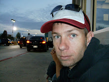
Hi - My name is Joe. For years, growing up in Utah I heard about one fascinating scout trip or another, time and again about this almost mysterious place called the Escalante river.
In my teens and early twenties I still had never made it to this area. My interests were turned in other directions, raising kids - a job, and all of the excitement that surrounds this period in life. During my mid-twenties I was locked in college pursuing a dream, hoping that these efforts would untie me from the long hours and weekends it took supporting a family.
Finally in my thirties, every excuse was exhausted and I would make my first venture into the Escalante area. Would time be to short, as were the dollars supporting my travels? Either way at least finally I could say I had been there. How would I travel? Who would want to go with me? With so many miles or terrain where should I start or end?
These questions were all that I needed to rekindle the wonders that I carried of this place as a child. I immediately began plans to expand and explore into the area. The Colorado Plateau is unique in many ways, it's landscape that twists and bends in every way except a straight line. The colors seem to dip and change with the shadows and sun. It is filled with boundless wonders and change and you travel mile after mile, but perhaps its most unique feature is the seemingly endless remoteness that envelopes this area.
How was I to take what I needed, to support myself in the extremes that make the hours of the day? With almost barren rocks and distance between water or shelter could I enjoy or even survive these conditions? Pouring over maps and information only compound the questions...can it be enjoyed? Can it be done?
These are all fair questions when you consider this area, and especially curious when you consider the river itself. The Escalante river was the last river to mapped in the continental United States. It's length wasn't even attempted until May 28, 1948. This is also considered to be one of the crooked rivers in the US.
So it was this path that lead me to the decisions to take on the area. To attempt the river itself, cutting through more than 75 miles of carved sandstone to it's confluence with Lake Powell. It would be this journey and the preparations to support it that inspired a quest that continues even today.
Subscribe to:
Post Comments (Atom)


No comments:
Post a Comment